

Before you dig a single pan of dirt on public land out west, you need to check for mining claims. A lot of the good gold ground is already claimed, and the person who holds the claim has the right to the minerals on it.
This step looks hard. It is not. The Bureau of Land Management keeps the records online in a system called MLRS, and anyone can search the public reports online for free.
No claim check, no digging.
Why You Need to Check for Mining Claims First
The BLM says a mining claim is a parcel of land where the claimant has asserted a right of possession and the right to develop and extract a discovered, valuable mineral deposit (BLM).
That right does not make the claim private land. The BLM Montana-Dakotas packet says the surface of an unpatented claim is still owned and managed by the United States, and the public has a conditional right to cross it (BLM Mining Claims Packet). You can walk across a claim. You cannot prospect it without permission.
The Black Hills National Forest says entering a claim without permission is claim jumping, which is trespassing (USFS Black Hills). It also says most easy-to-find deposits are already claimed.
Claims are not small, either. The BLM says a placer claim can be up to 20 acres per locator, and an association placer of 8 or more locators can be up to 160 acres (BLM).
What You Need Before You Start
To check for mining claims in MLRS, you need a survey location, not a street address. MLRS searches by the Public Land Survey System, which means a meridian, township, range, and section. MLRS calls that combination an MTRS code.
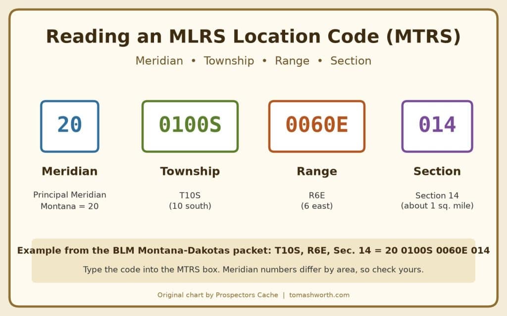
The BLM Montana-Dakotas packet gives this example: Principal Meridian Montana, T10S, R6E, Section 14 is entered as 20 0100S 0060E 014 (BLM Mining Claims Packet). The packet says to type the code in rather than use the picklist.
You will also need the admin state. Some BLM state offices cover more than one state. For example, the packet says to use MT for claims in Montana, North Dakota, or South Dakota.
How to Check for Mining Claims in MLRS, Step by Step
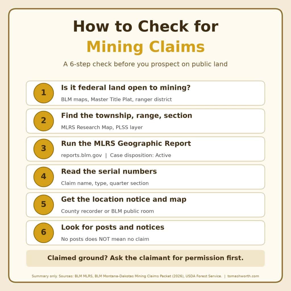
Step 1: Make Sure the Land Is Open
The BLM does not keep a list of federal land that is open for mining or recreational use (BLM Mining Claims Packet). You have to check that the ground is federal and open to mineral entry. The packet points you to BLM surface management maps and the Master Title Plat, where the note NOM means the area is not open to mining claims or mineral entry.
On national forests, the Forest Service lists areas that may be closed even to hobby prospecting, including wilderness areas, campgrounds, Wild and Scenic River corridors, archaeological sites, and areas withdrawn from mineral entry (USFS Northern Region). If you are not sure, call the ranger district. My guide on where you can metal detect covers the land types in more detail.
Step 2: Find Your Township, Range, and Section
The BLM MLRS Research Map has national layers for the Public Land Survey System and surface management agency (BLM). The BLM says that once you are logged in, you can also search the map by name or legal land description (BLM MLRS). Zoom to your creek, turn on the survey layer, and write down the meridian, township, range, and section.
Step 3: Run the Geographic Report
Go to the MLRS Reports page and open Mining Claims – Geographic Report under Public Mining Claims Reports. The BLM packet lays out the steps:
- Pick the admin state.
- Type your MTRS code into the Meridian Township Range Section box.
- Set Case Disposition to Active.
- Pick the quarter section you care about.
- Click OK.
The packet says that if you enter the code correctly and it disappears when you click out of the box, there are no claims in that section. A No Results message can mean there are no claims, or that the entry was typed wrong. Double-check the code before you trust an empty result.
Step 4: Read the Results, Then Check the Map
Each claim has a BLM serial number. Write down the serial number, the claim name, the claim type (placer or lode), and the quarter section. You can pull more detail with the Serial Register Page report on the same reports page (BLM MLRS Reports). The page notes that the public reports have Privacy Act redactions.
The BLM also publishes a map layer of claims that are not closed (BLM MLRS map service). When you check for mining claims on the map, treat it as a starting point. The BLM says the Research Map only shows detail past the quarter-quarter when claimants upload their claim shapes (BLM).
Step 5: Get the Location Notice and Map
The real boundaries are in the claimant’s notice or certificate of location and map. Federal rules say the claimant must record it with the BLM state office within 90 days of the date of location (43 CFR 3833.11). The BLM says it must also be filed with the county recording office (BLM).
The packet says you can use the nine-digit serial number to get the location notices and maps through MLRS, or request older ones from the BLM public room (BLM Mining Claims Packet). The county recorder is the other place to look. Then mark the claims on your own map so you know where you may or may not prospect.
Step 6: Look on the Ground
The BLM says claimants must still stake the boundaries, mark the corners and the location monument according to state law, and post a notice of location at the monument (BLM). Depending on the state, that can mean corner posts and a discovery monument (BLM Mining Claims Packet).
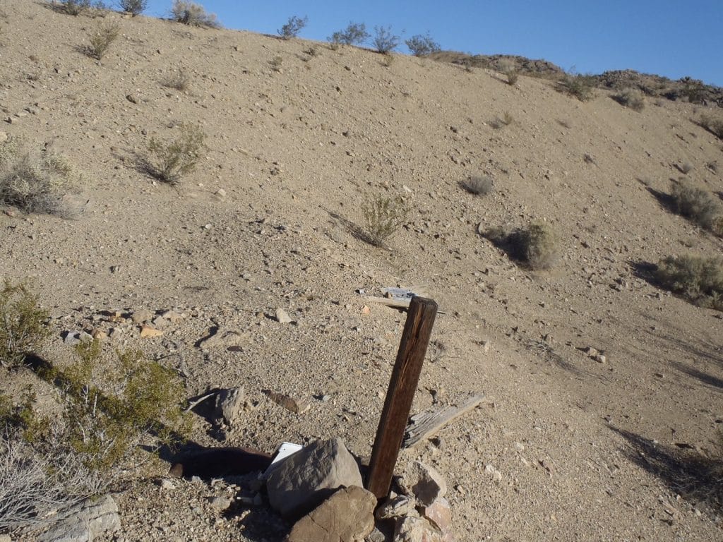
The Black Hills National Forest says to look for claim markers before you prospect, and to contact the BLM if you cannot find the corner posts on the ground (USFS Black Hills). If you cannot find posts, do not assume the ground is open. Trust the records first and the posts second.
What If the Ground Is Claimed?
Ask the claimant for permission. That is what the BLM packet says to do (BLM Mining Claims Packet), and the Forest Service says the same thing (USFS Northern Region). Get the yes in writing and carry it with you.
Another option is a club. The GPAA says its membership gives access to 227 listed locations, including member claims, leases, and public prospecting areas (GPAA).
If two people stake the same ground, the BLM packet says the BLM will not settle the dispute. That is between the parties or a civil court.
What If the Ground Is Open?
If you check for mining claims and find none, you can prospect within the rules for that land. The Black Hills National Forest says panning or sluicing with hand tools and non-motorized equipment is normally allowed without Forest Service authorization or a bond, but motorized equipment and suction dredges need a Notice of Intent (USFS Black Hills). State rules can add permits, so check those too.
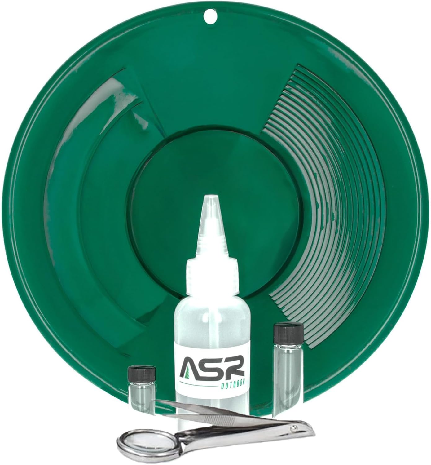
Start simple. A good 14 inch dual riffle gold pan is all you need to sample a creek. If you want a pan, snuffer bottle, and vials together, the ASR Outdoor 5-piece beginners kit covers it.
New to the pan? Read my guide on how to pan for gold. Ready to move more material? My sluice box guide covers setup and the rules. If you prospect in Texas, where most land is private, read gold prospecting in Texas instead.
Gear From Prospectors Cache
I keep prospecting gear in my Etsy shop, ProspectorsCacheShop, and in my Prospectors Cache eBay store.
Final Thoughts
It does not take long to check for mining claims, and it can save you a lot of trouble. Confirm the land is open. Find your township, range, and section. Run the Geographic Report. Get the location notice if a claim is close. Look for posts, but do not rely on them.
Claim records change, so run the report again before each trip. If the ground is claimed, ask first or find another spot.
Sources
- Bureau of Land Management: Mining Claims
- BLM Montana-Dakotas: Mining Claims Packet (March 12, 2026, PDF)
- Bureau of Land Management: Mineral & Land Records System (MLRS)
- BLM Reporting Application: MLRS Reports
- BLM: Ten Things to Know About the MLRS Mining Claims Module (2021)
- BLM: Six Things to Know About MLRS Release 4.0 (2024)
- BLM National MLRS Mining Claims (Not Closed) map service
- 43 CFR 3833.11: How do I record mining claims and sites?
- USDA Forest Service, Black Hills National Forest: Gold Panning, Rockhounding, and Metal Detecting
- USDA Forest Service, Northern Region: Recreational Prospecting in Montana
- Gold Prospectors Association of America: Join GPAA
Written by Tom Ashworth
Prospectors Cache